Home Unlocking Regional Memory
Archival Resources

Home | Browse | Search | Previous | Next

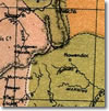
Armidale and New England Region (c. 1830 - )

PlacePublished Resources
University of New England and Regional Archives, Heritage Centre
 
[Repository details]
Reference:A0283
Date Range:1827 - 1922
Description:

Mostly photostats of maps held in other collections. Included are: Allan Cunningham's 'Sketch Map Hunter's River to Moreton Bay' (1827); Surveyor Gorman's 'Map of the town of Armidale' (1849); William Gardner's 'Sketch Map of Northern NSW' (1854) and E. Knapp's 'Map of Bergen-op-Zoom Run' (1854). There is also a number of maps and plans of Sandon county mostly drawn in the 1890s and a geological map of the Hillgrove goldfield (1900). A map produced as an auctioneer's advertisement regarding sale of lots at Tilbuster Bally Glass and Clark Hill estates (1922) is the most recent in the group.

Formats:20 maps
Top of Page

Published by The Australian Science and Technology Heritage Centre, 5 April 2004
Prepared by: Acknowledgements
Updated: 23 February 2010
http://www.nswera.net.au/archives/UNE0028a.htm

[ Top of page | Unlocking Regional Memory Home | Browse | Search ]